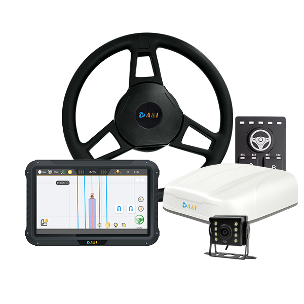
Tractor guidance is fundamentally a positioning problem combined with a steering problem. A machine needs to know where it is within a field, where it should travel next, and how far its current path has moved away from the intended route. Agricultural GPS guidance systems provide the positioning information that turns these requirements into a continuous navigation workflow.
Rather than simply displaying the tractor’s location, a modern guidance system can provide the reference information needed to establish field paths and support automatic steering. The result is a closer connection between route planning and the tractor’s actual movement.
Where GPS Guidance Enters the Tractor’s Route-Planned Workflow?
Field navigation begins with a spatial reference. The tractor’s position can be determined through GNSS, allowing its location to be represented relative to the field and any planned operating paths.
Once the field boundary, working area, or desired route has been established, the guidance system can provide a reference line for the tractor to follow. Parallel paths are particularly relevant to agricultural operations where the same working width must be maintained across successive passes.
Archimedes Innovation’s AS10 is an agricultural GNSS receiver designed for applications including tractor auto-steering and precision agriculture. The product information identifies positioning and heading functions as part of its role in agricultural machinery.
A route therefore becomes more than a line displayed on a screen. It becomes a spatial reference against which the tractor’s position and direction can be evaluated while the machine moves through the field.
How a Planned Line Becomes a Steering Reference?
Route planning only becomes useful when the tractor can determine its relationship to the planned path. The guidance system compares the tractor’s current position with the reference line and identifies deviations from the desired trajectory.
Heading is equally important. A tractor can be close to a guidance line while pointing in the wrong direction. Position and orientation therefore work together to establish whether the vehicle is approaching, following, or departing from the intended path.
An agricultural GPS guidance system can continuously update this relationship as the tractor moves. The resulting information gives the steering controller a basis for determining the direction in which the machine should be corrected.
AS10 supports dual-antenna GNSS positioning, according to Archimedes Innovation’s published product information. Dual-antenna configurations can provide heading information directly from the relative positions of two antennas, which is relevant to vehicle guidance applications.
The distinction between location and heading is important because steering depends on both. Route following is therefore an ongoing spatial calculation rather than a single GPS measurement.
What the Autosteer System Corrects While the Tractor Is Moving?
A tractor autosteer system takes the guidance information and uses it to influence the tractor’s steering. The objective is not simply to identify that the machine has deviated from the route, but to respond to that deviation while the tractor continues moving.
The steering controller can use positioning and heading information to determine the required correction. Depending on the tractor and control architecture, this information can be communicated to the vehicle’s steering system, where appropriate adjustments are made to keep the machine aligned with the guidance path.
Archimedes Innovation identifies AS10 as supporting automatic steering applications and lists interfaces including CAN and RS232. Such interfaces can provide communication between the positioning equipment and other components of an agricultural guidance architecture.
The quality of the correction depends on the quality and continuity of the information available to the control system. Positioning errors, unstable heading estimates, communication problems, or unsuitable system configuration can all affect how effectively the tractor follows its intended path.
Why Positioning Continuity Matters Across Repeated Field Passes?
Agricultural operations frequently involve repeated passes through the same field. Planting, cultivation, spraying, and harvesting can require machinery to follow paths that remain consistently separated and aligned.
A positioning system that provides repeatable guidance information can help the tractor maintain its relationship with previously established routes. The requirement is particularly relevant when the operator needs consistent pass-to-pass positioning rather than simply knowing the tractor’s approximate location.
AS10 is described by Archimedes Innovation as supporting RTK positioning, with the product page specifying centimeter-level positioning accuracy under stated conditions. The exact performance achieved in practice depends on the complete positioning setup and operating environment.
This illustrates why an agricultural guidance architecture needs more than a basic location signal. Repeatable field work depends on the positioning method, correction source, antenna configuration, terrain, signal conditions, and integration with the tractor’s steering system.
What Farmers Need From the Guidance System During Field Work?
A useful guidance system must function as part of the tractor rather than as an isolated positioning device. The positioning receiver provides location and heading information, while the guidance software establishes the route and the steering system acts on the resulting corrections.
The physical environment also influences system design. Agricultural machinery operates outdoors and can encounter dust, vibration, temperature changes, uneven terrain, and variable satellite visibility. Equipment specifications therefore need to be considered alongside the application’s communication and mounting requirements.
Archimedes Innovation‘s AS10 combines GNSS positioning with functions intended for agricultural machinery, including automatic steering and precision agriculture. Its stated operating concept demonstrates how positioning can serve as the foundation for a larger tractor guidance workflow rather than functioning solely as a location display.
The answer to how agricultural GPS guidance systems assist tractors is ultimately found in the interaction between three functions: determining where the tractor is, defining where it should travel, and continuously identifying the correction needed to keep it on course.
Route planning establishes the path, GNSS positioning provides the tractor’s spatial reference, and autosteer converts that information into steering action. When these elements are properly integrated, agricultural machinery can follow planned field paths with greater consistency and reduced dependence on continuous manual steering.
